


 RSS Feed
 Email
 Twitter
 Facebook
First ‘Satellite Remote Sensing Laboratory’ inaugurated
 Twitter
 Facebook
 Delicious
 Digg
 Stumble
 Reddit
 Ahmed Bakhsh Narejo, Secretary Agriculture, Supply & Prices Sindh inaugurated first “Satellite Remote Sensing Laboratory” of the country At Crop Reporting Services Centre, Directorate General Agriculture Extension, Agriculture, Supply and Prices Department, Government of Sindh, Hyderabad.
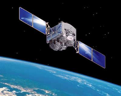
This laboratory is established with the collaboration of Pakistan Space and Upper Atmosphere Research Commission (SUPARCO) and Food and Agriculture Organisation (FAO). The purpose of this laboratory is crop monitoring, forecasting and estimation around the year through satellite remote sensing technology to ensure the ground realities in a scientific manner.
Satellite Remote Sensing System assists in monitoring the conditions of the crops, enables estimation of yields provides information on prevailing conditions in different agriculture areas to enable planners, policy makers and other end users to take timely measures to maintain the quality of the crop. In this system initially activities are restricted to monitoring of the main cash crops including wheat, rice, cotton, sugarcane, but system could be enhanced in future.
Through this laboratory Crop Reporting Services Centre Sindh will be able to issue a monthly web based bulletin on crop situation and statistics. The project interventions will be carried out in Sindh Province in districts Hyderabad, Matiari, Tando Allahyar, Tando Muhammad Khan, Badin, Sukkur, Khairpur, Ghotki, Thatta, Larkana, Sanghar, Mirpurkhas, Shikarpur, Dadu, Jacobabad, Naushahroferoze and Nawabshah.
Assistant Directors, Crop Reporting Services Centre Sindh of the each district have given mobile phone sets, EVO internet connectivity along with satellite supported software to collect the information from field and send to the Satellite Remote Sensing Laboratory Hyderabad.
Technical staff of this programme already has been trained by the SUPARCO at Islamabad and Karachi and University of Maryland, USA about crop reporting enhancement using remote sensing and geographic information system. Along with crop reporting staff three Researchers from the fields of Agronomy, Remote Sensing and Geographic Information System (GIS) will be the part of this system to run and get the required results. In the inauguration ceremony of “Satellite Remote Sensing Laboratory” At Crop Reporting Services Centre, Hidayatullah Chhajro, Directorate General Agriculture Extension, Sindh welcomed the guests. Technical presentation about “Monitoring of Crops through Satellite Technology” was given by Abdul Gaffoor, Director SUPARCO and Hayat Khan Manager SUPARCO.
Noor Muhammad Baloch, Director Crop Reporting Services Centre, gave the information about traditional agriculture information gathering. In the last, Ahmed Bakhsh Narejo, Secretary Agriculture, Supply & Prices Sindh appreciated the efforts taken by the SUPARCO, FAO and Crop Reporting Services Centre for the establishment of laboratory and field system. He ensured that the department will take all necessary steps for the sustainability of the programme. Agha Zaffarullah Durrani, Director General Agriculture Engineering and Water Management of Sindh Hyderabad, Dr Ata Hussain Soomro, Director General, Agriculture Research Sindh Tando Jam, Hayat Khan Manager SUPARCO and other senior officers and field staff of the department attended the ceremony.
Business Recorder
Related articles
Incoming search terms:
- remote sensing satellites with country
- sparco karachi master degree program scholarship crops monitoring for foreign countries assist of FAO organization
10:47 am
Dear Sir,
I am pleased to learn about your facility of remote sensing for agricultural purposes. I would be grateful if you could contribute a paper on the use of remote sensing for agricultural purposes in Pakistan .
I am editor Farming Outlook from Islamabad , and look forward to hearing from you .
M.Tahir Saleem